


Currys Fork Watershed
Christine Svidal
Currys Fork Watershed Coordinator
Oldham County Soil & Water Conservation District
1002 Buckner Center Drive, Suite 4
La Grange, KY 40031
502-702-9090
ocwatershedcoordinator@gmail.com
Everywhere you live, work, and play . . .YOU ARE IN A WATERSHED.
Currys Fork Watershed Stewards
Are you interested in learning more about what we're doing to clean up Currys Fork Watershed? Would you like to become a Currys Fork Watershed Steward through participating in workshops, tree plantings, education, organizational help, or other opportunities? Please email the Watershed Coordinator.
What is a Watershed?
A watershed is simply the land that "sheds" rainwater to a certain water body. It's an area of land where all water running off the land drains to a specific water body (such as a stream, river, lake, wetland or ocean). Water may soak into the ground and become groundwater that flows to one of these water bodies.
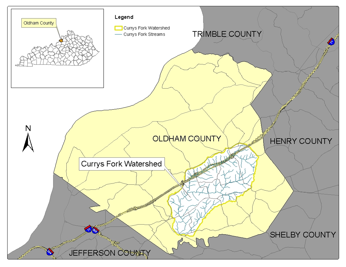
Am I in Currys Fork Watershed?
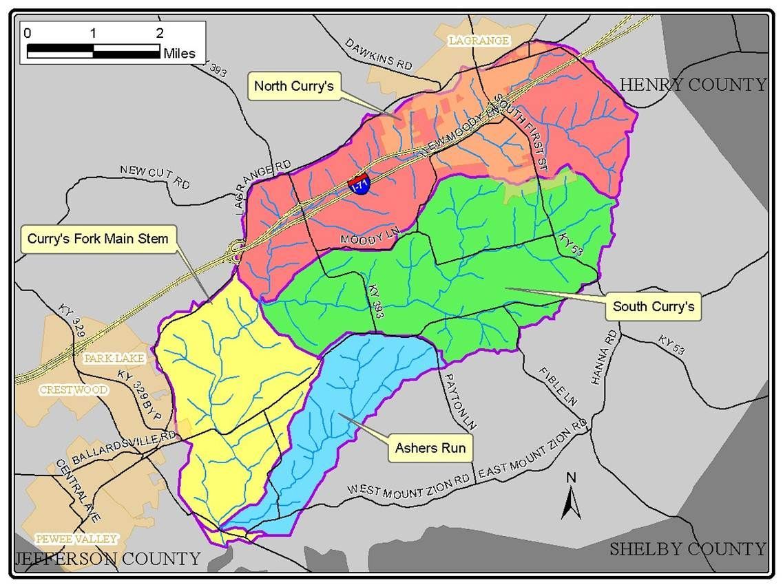
The Currys Fork watershed is located upstream of Floyd’s Fork in the southcentral portion of Oldham County, Kentucky. Most of the City of La Grange is included in the northeast corner of the watershed, which extends southwest, roughly along Highway 146 to the eastern edge of the City of Crestwood. Currys Fork watershed is roughly bordered on the north by the railroad tracks north of Interstate 71. The southern border runs roughly parallel with Montfort Lane.
Look at the maps below to see if you are in Currys Fork Watershed.
Is the water safe in Currys Fork Watershed?
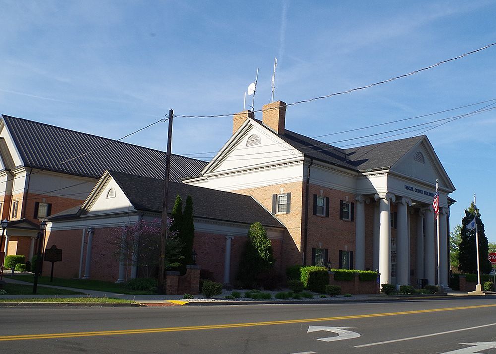
Currys Fork is listed as a first priority stream by the Kentucky Division of Water (KDOW), meaning that the waters are impaired and do not meet water quality standards. The suspected pollutants include sediment, bacteria, low dissolved oxygen and alteration of stream path. As part of a U.S. Environmental Protection Agency grant through the Kentucky Division of Water, Oldham County Fiscal Court performed a detailed study of the Currys Fork streams. This effort involved developing a watershed plan, which addresses sources of pollution and identifes solutions for cleaning up Currys Fork streams. Thanks to additional federal grants, Oldham County Fiscal Court is now implementing key initiatives in the plan and working to improve our water for future generations.
Watershed Glossary
The following is a list of some commonly used terms regarding watersheds. But first and foremost, let's define what a watershed is.
A watershed is an area of land where all precipitation that falls on it drains off and goes to the same place. The watershed acts as a funnel, collecting all water within the area and draining it into a common stream, pond, or river. Each watershed is separated topographically by a watershed divide, which is a geographical barrier such as a ridge, hill, or mountain.
Aquifer
A geologic formation(s) that is water bearing. A geological formation or structure that stores and/or transmits water, such as to wells and springs. Use of the term is usually restricted to those water-bearing formations capable of yielding water in sufficient quantity to constitute a usable supply for multiple or varied uses such as drinking water, agriculture, or industry.
Best Management Practice (BMP)
Effective and practical methods which prevent or reduce the movement of sediment, nutrients, pesticides and other pollutants from the land to surface or ground water, or which otherwise protect water quality from potential adverse effects of silvicultural activities. These practices are developed to achieve a balance between water quality protection and the production of wood crops within natural and economic limitations.
Channelization
Any change to a stream that moves, straightens, shortens, or alters the current flow conditions of a stream.
CWA Section 319
Section of the Clean Water Act concerning nonpoint source pollution. The number is often used alone as either a noun or adjective to refer to some aspect of that section of the law, such as grants.
Erosion
The process where material is worn away by a stream, often due to the presence of abrasive particles in the stream or increased stream flow due to channelization. Erosion also occurs due to transport by wind or ice; by down-slope creep of soil and other material under the force of gravity; or by living organisms, such as burrowing animals.
Flood Plain
A strip of relatively flat and normally dry land alongside a stream, river, or lake that is covered by water during a flood.
Gage Height
The height of the water surface above the gage datum (zero point). Gage height is often used interchangeably with the more general term, stage, although gage height is more appropriate when used with a gage reading.
Gauging station
A site on a stream, lake, reservoir or other body of water where observations and hydrologic data are obtained. The U.S. Geological Survey measures various hydrometry readings at gauging stations such as volumetric flow rate, water quality and observations of biota.
Ground water
(1) water that flows or seeps downward and saturates soil or rock, supplying springs and wells. The upper surface of the saturate zone is called the water table. (2) Water stored underground in rock crevices and in the pores of geologic materials that make up the Earth's crust.
Hydrologic Unit Code
The United States is divided and sub-divided into successively smaller hydrologic units, or watersheds, which are classified into four levels: regions, sub-regions, accounting units, and cataloging units. The hydrologic units are arranged within each other, from the smallest (cataloging units) to the largest (regions). Each hydrologic unit is identified by a unique hydrologic unit code (HUC) consisting of two to eight digits based on the four levels of classification in the hydrologic unit system.
Maximum Contaminant Level (MCL)
The designation given by the U.S. Environmental Protection Agency (EPA) to water-quality standards promulgated under the Safe Drinking Water Act. The MCL is the greatest amount of a contaminant that can be present in drinking water without causing a risk to human health.
Milligrams per Liter (mg/l)
A unit of the concentration of a constituent in water or wastewater. It represents 0.001 gram of a constituent in 1 liter of water. It is approximately equal to one part per million (PPM).
Nonpoint Source (NPS) Pollution – NPS comes from many diffuse sources. NPS pollution is caused by rainfall or snowmelt moving over and through the ground. As the runoff moves, it picks up and carries away natural and human-made pollutants, finally depositing them into lakes, rivers, wetlands, coastal waters, and even underground water sources. These pollutants typically include:
- Excess fertilizers, herbicides, and insecticides from agricultural lands and residential areas
- Oil, grease, and toxic chemicals from urban runoff and energy production
- Sediment from improperly managed construction sites, crop and forest lands, and eroding stream banks
- Salt from irrigation practices and acid drainage from abandoned mines
- Bacteria and nutrients from livestock, pet wastes, and faulty septic systems
Potable Water
Water of a quality suitable for drinking.
Riparian
Pertaining to the banks of a river, stream, or flowing water bodies as well as to plant and animal communities along such bodies of water.
Stream – A general term for a flowing body of water, usually applied to water flowing in a natural channel and not a man made channel or waterway. There are many stream classifications; the three most common are:
(1) Ephemeral Streams – Streams which flow only after precipitation events and are always above the water table.
(2) Intermittent or Seasonal Streams – Streams which flow only at certain times of year when it receives water from springs, rainfall, or other source.
(3) Perennial Streams – Streams which flow continuously.
Surface Water
An open body of water such as a stream, lake, or reservoir that remains naturally exposed to the atmosphere.
Total Maximum Daily Load (TMDL)
The calculation of the maximum amount of a pollutant that a waterbody can receive and still meet water quality standards. Also includes an allocation of the pollutant’s source.
Tributary
A stream which joins another stream or body of water.
Water Cycle
The cycle that controls the distribution of earth’s water. Also called the Hydrologic Cycle.